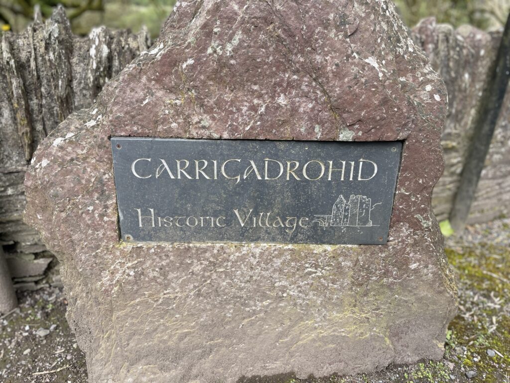
In my last blog I wrote about the farm and the enormous project that we were undertaking, so in this blog I am going to share some of the local walks I managed to fit in between all the hard work! Carrigadrohid, which Bob still can’t pronounce, is a small village set in the Cork countryside close to a dam of the same name. The dam was built in 1952 to help reduce the extent and frequency of flooding along the Lee Valley and into Cork City. It is part of an ESB hydroelectric power station but the construction of the reservoir to power the plant flooded 60% of an ancient alluvial forest. Alluvial is the loose clay, sand or gravel that is deposited from running water in a stream or riverbed. These deposits are often extremely fertile and of huge geographical importance so the flooding temporarily effected the wildlife of the area that homed trout, otters, eels and freshwater pearl mussels; however luckily the area has now seen the growth of a new ecosystem that includes kingfishers, otters, salmon and swans and has been designated an EU Special Area of Conservation.

The Gearagh (Irish name An Gaorthadh meaning ‘the wooded river valley’ or ‘the riverbed’) where the flooding took place has its own sad story. Until the flooding, within this area there was an Ancient Oak Forest, sadly the last surviving full oak forest in western Europe. Many oaks were felled, some centuries old dating back to medieval times and many locals were relocated. Livelihoods and communities that had lived in this area for centuries relied on the forests and flood lands that were destroyed and they were forced to move against their will, find new lives and new jobs, some never recovered and some even refused to leave. You can still see the remains of houses when the water level is low.

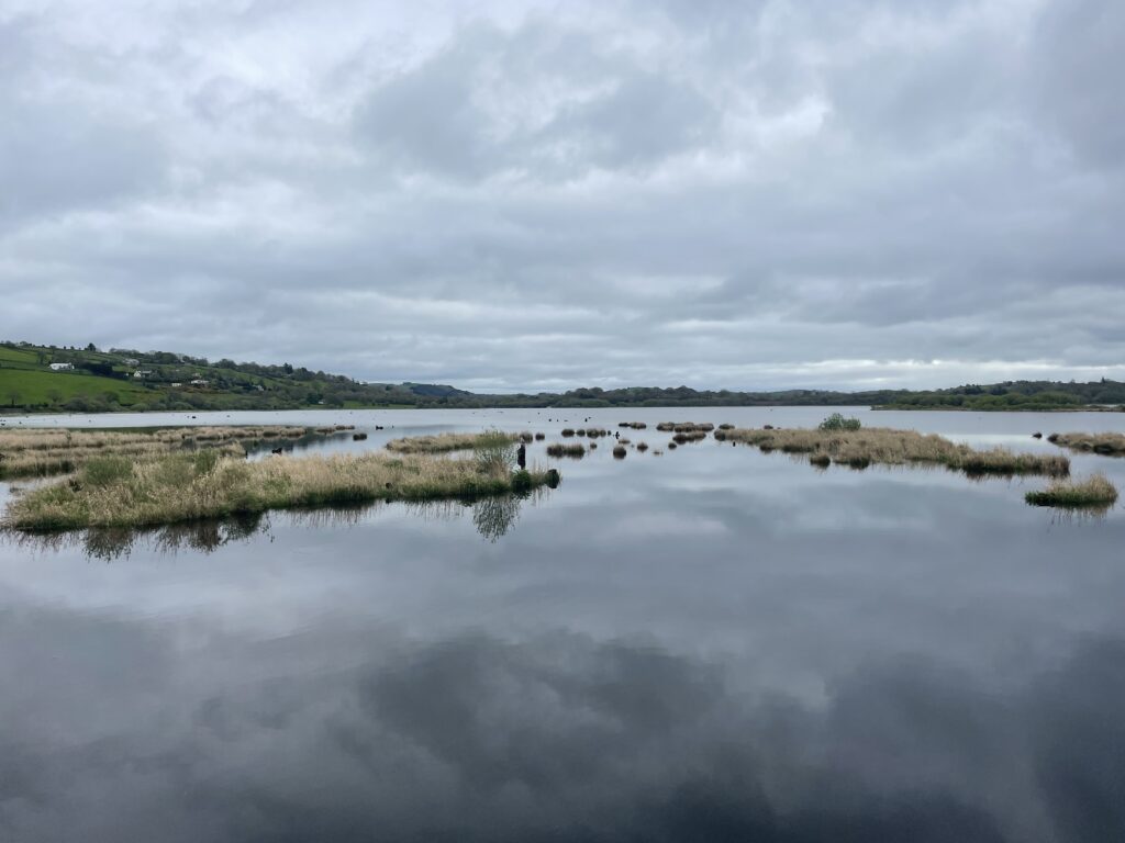


One benefit is the beautiful walks of the Gearagh, about a 10 minute drive and I did a couple whilst I was there with George. The oak stumps sticking out of the water makes it very atmospheric, it is very tranquil and you can watch birdlife and butterflies amongst the native flora with the eerie backdrop of the reservoir that houses the remains of the ancient oaks.
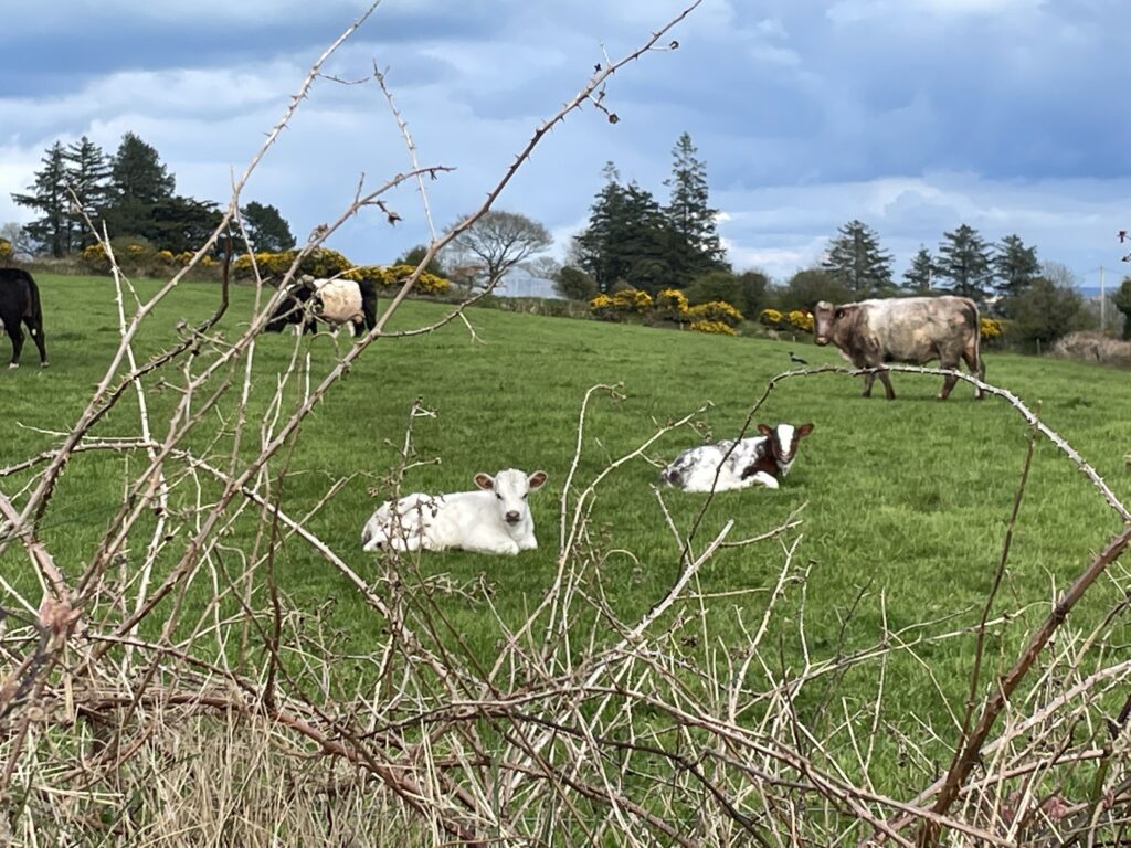
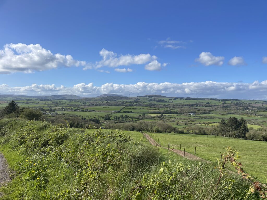
The Farm is sited about 1 km off the main road through the village on what are known as ‘green stripe’ roads, tarmacked roads that have grass growing down through the middle – shows that they are little used and usually very quiet apart from the odd tractor or resident who lives in the area.
I walked several routes from the Farm – but whichever way you walked you had to walk back up the steep hill to the farm. How else would we get those views?


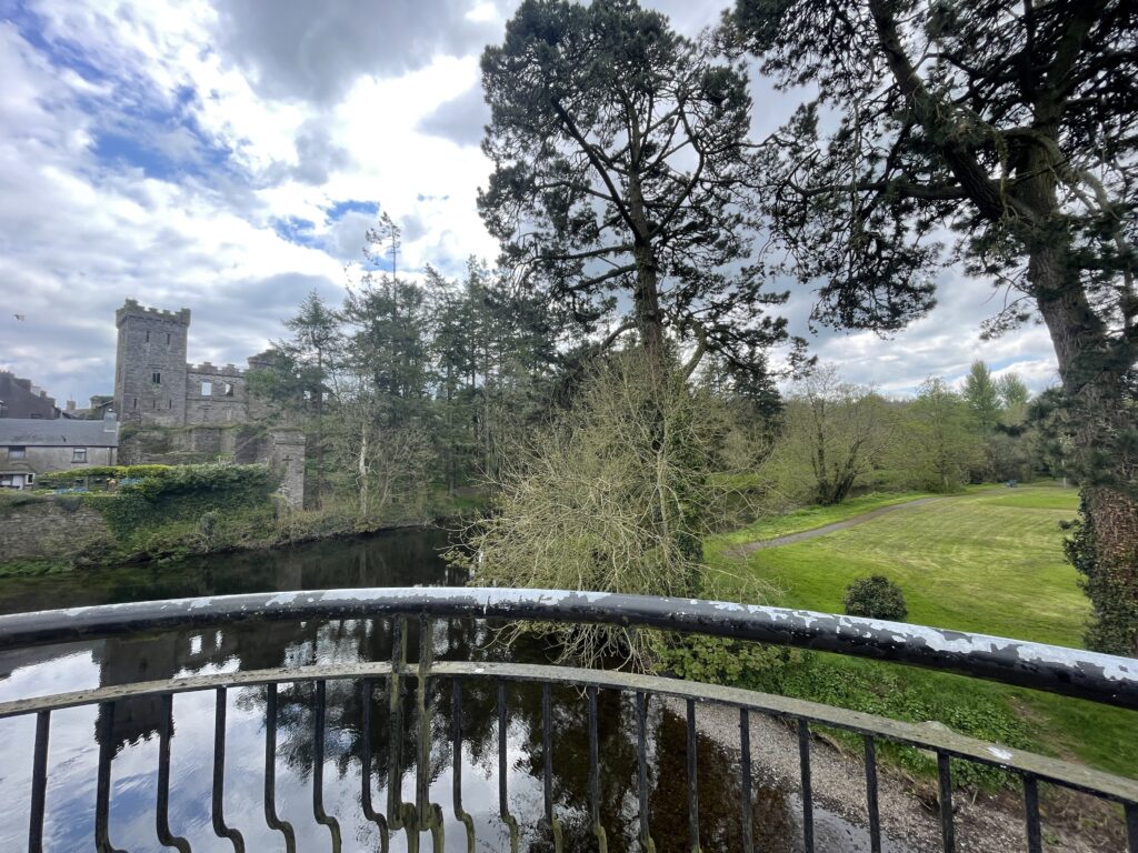
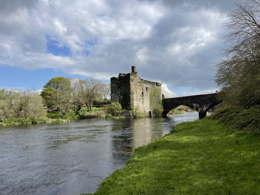
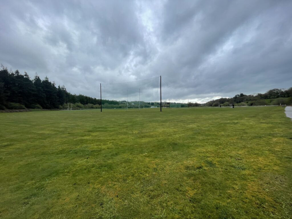
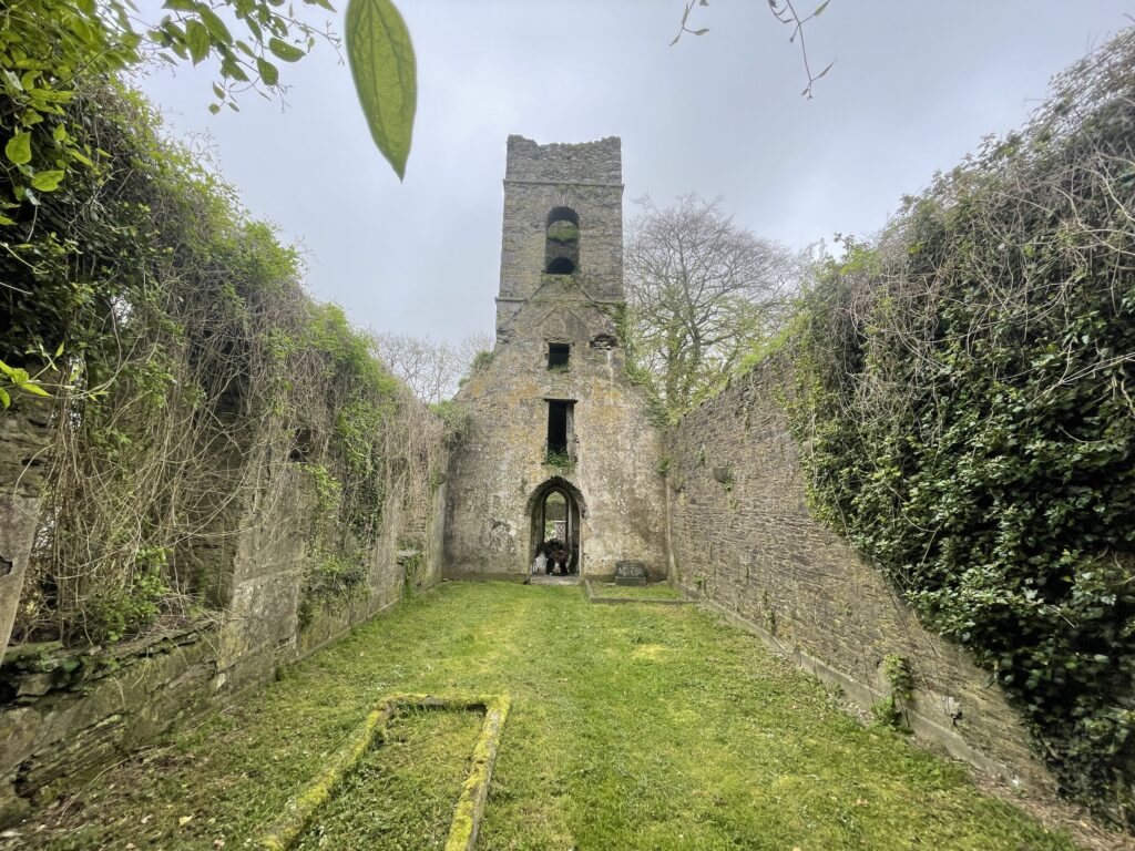
In the village there is a castle ruin that stands on a rock in the river Lee, built by the McCarthys of Muskerry who the Kings of the province of Munster were once. Cormac McCarthy lived there in the 15th century until he was disposed of by Cromwellian army in 1680. In the 17th century the Bowens, a Welsh family acquired the castle when they were awarded land in the area and the family lived in the castle until it was abandoned in the early 19th century. They have subsequently bequeathed the castle to the village. Adjoined to the castle is a beautiful old bridge across the river and there are some short walks around here. I tracked a route that took me from the farm to the castle and along the river to the local GAA ground.


GAA (Gaelic Athletic Association) is Irelands largest sporting association and is celebrated as one of the great amateur sporting associations in the world. GAA grounds are in every town and play a very influential role in Irish society. It embodies all that is Irish and they play spots such as hurling, Gaelic football, handball and rounders. They also promote Irish music, song and dance and the Irish language. Everyone is a volunteer and no players whatever level are paid and it this ethos that they built their reputation on.
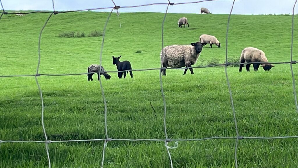
Remember that Ireland has very limited walking trails across farmland so you are limited with walking the roads and lanes. So, it was nice that the local roads were green stripe roads as they were quiet and mostly car free. Most of the time the only thing I could hear was the non-stop birdsong.


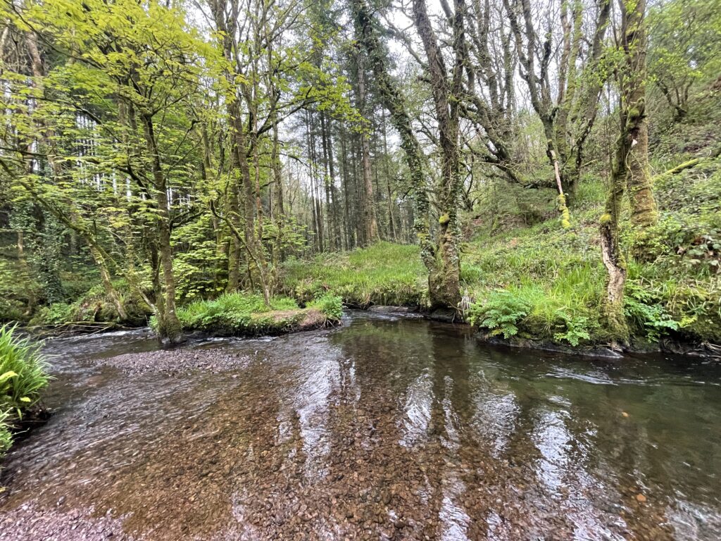

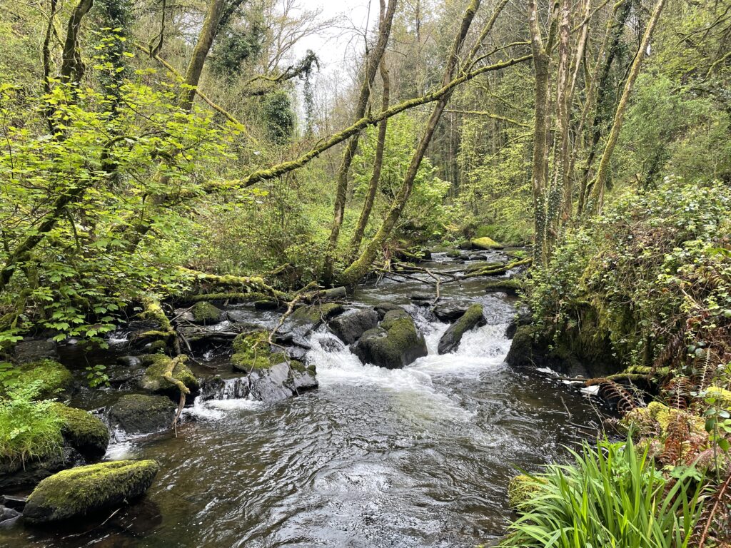

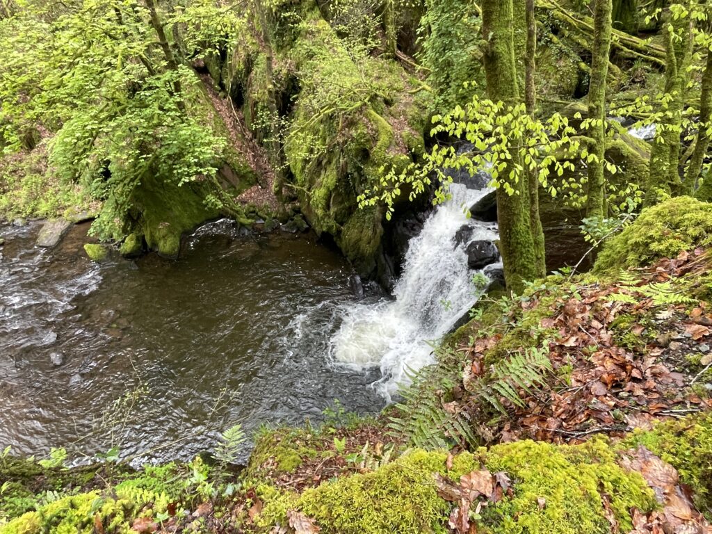

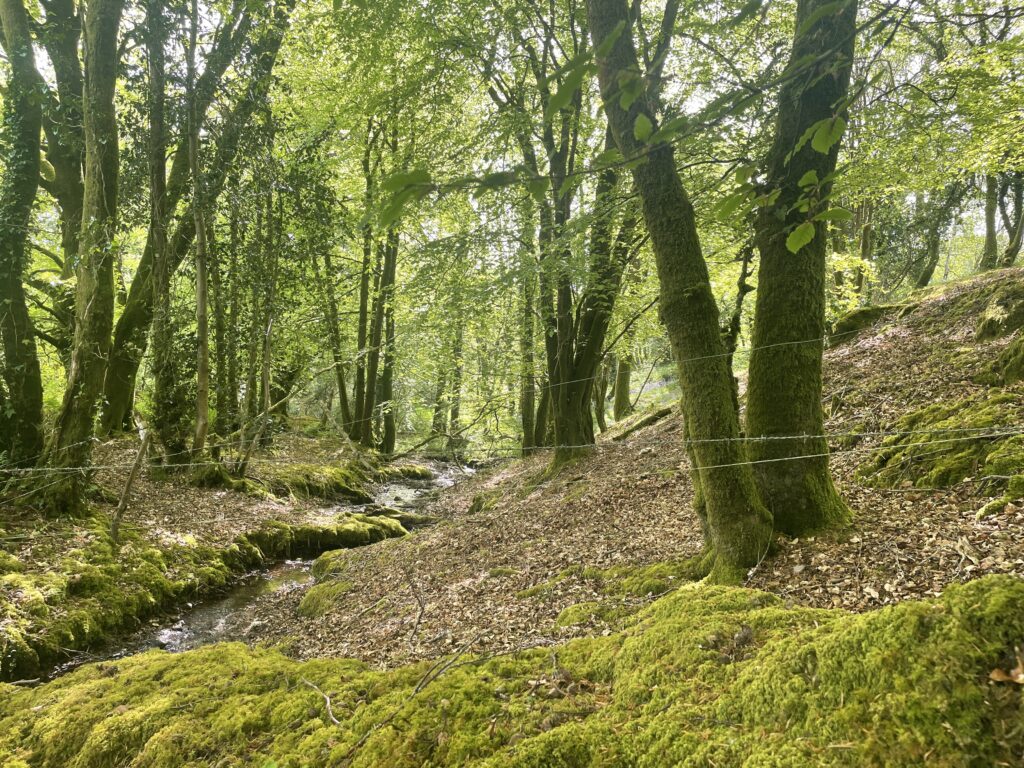
The forests that are open to the public are managed by Coillte the custodian of 440,000 hectares of land mainly forests. They look after a local beauty spot Mullinhassig Wood and Waterfalls. I took George here several times, it was a beautiful place full of native woodland and birdsong with paths along the stream bed and places to paddle or dip in, rock pools leading to a waterfall at the end of the track.


Another local walk was the Coachford Greenway. Greenways are trails built exclusively for use by cyclists, pedestrians and other non-motorised transport. They are very popular on disused railways lines that have been repurposed and some are built along river and canal towpaths. The Coachford greenway is only 2.8km linear walk along Inniscarra Lake but some of the Greenways are over 100km long and we walked along a few of them whilst on our trip last year.


I thoroughly enjoyed exploring the area but I think I have only touched the surface of walks, once we get to know our neighbours more I have heard that they will let you walk on their land and we have some big hills around to walk up as well as trips further afield to mountain ranges like Gougane Barra a valley the includes the source of the river Lee.
Our next trip was to be Scandinavia in June for 6 weeks but the day before we were due to leave I managed to slip whilst walking with George and my foot folded under me, injuring and inflaming my big toe to the extent I am now in a medical boot for the next 3/4 weeks. Not ideal on venturing on our next trip walking in Norway.……So new plans are being drawn up for more travels later, for now we are back to Dorset for the summer. Not a bad place to be……


